|
| Title: |
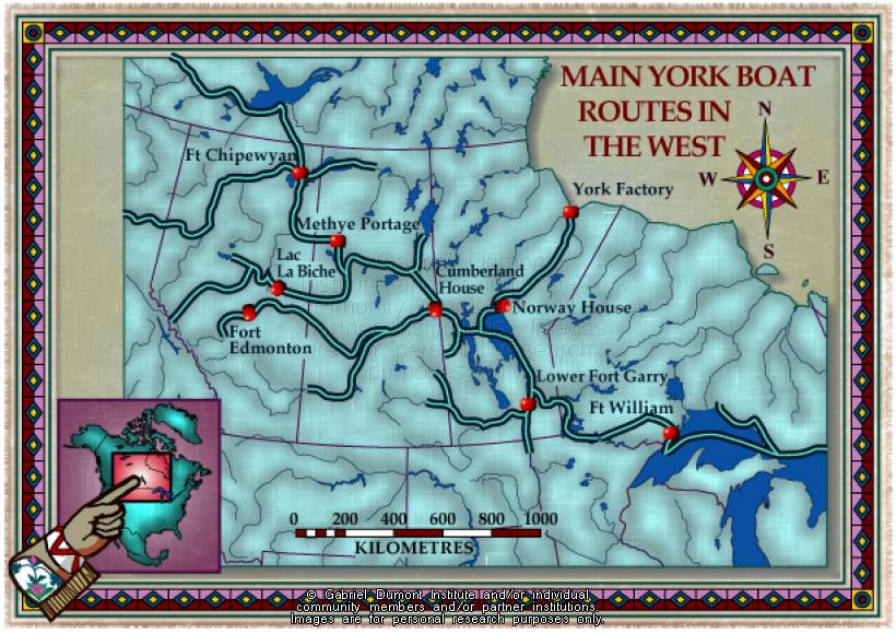
Western Canada, Main York Boat Routes |
| Creator: |
Gabriel Dumont Institute |
| Subject: |
Geography, Maps, Fur Trade, History, Hudson's Bay Company |
| Description: |
This map illustrates the main York Boat routes used in the nineteenth century Prairie West and the "Athabasca Country". The map was originally produced by the Gabriel Dumont Institute for the CD-ROM, "The Metis: Our People, Our Story". |
| Publisher: |
Gabriel Dumont Institute |
| Type: |
Image |
| Format: |
image/jpeg |
| Language: |
English |
| Date of Copyright: |
May 30, 2003 |
| Coverage: |
Alberta, Saskatchewan, Manitoba, Ontario |
| GDI Media Location: |
GDI Images Disk Oct 2/2002 |
| GDI Media Filename: |
gdi_m006.jpg |